THE BATANG KANYAU IBAN AROUND BETUNG KERIHUN NATIONAL PARK (I)
Date: Dec. 2000 - Jan. 2001, May 2002
Nikon FM-2 (film: -, ASA: 200)
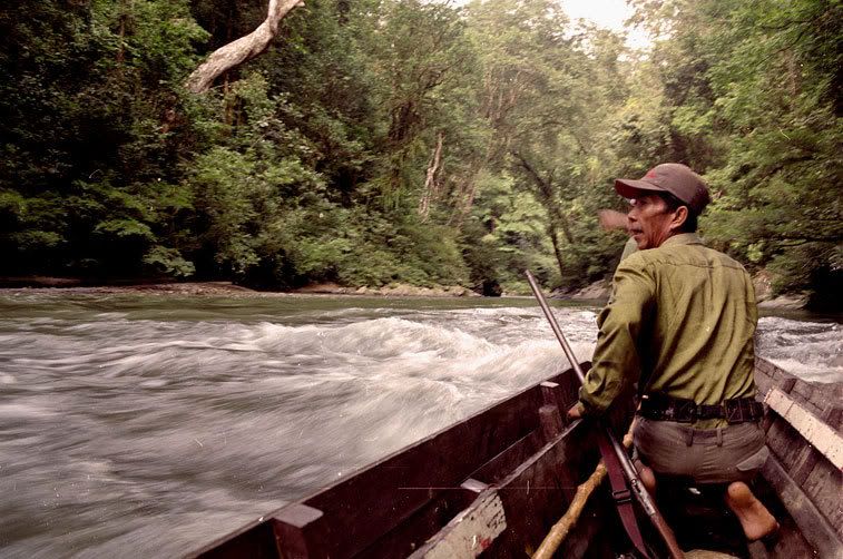
Betung Kerihun National Park (Taman Nasional Betung Kerihun - or TNBK) in Kapuas Hulu District, West Kalimantan, stretches along the Kalimantan - Sarawak border, spanning the vast distances between the Embaloh (or in Iban, Batang Kanyau) river in the west to the Upper Kapuas to the east.
Illegal logging within the park (which implicated a vast transnational network involving Sarawakian timber moguls, local politicians and Ibans) became a major concern nationally between 2002 - 2005. These pictures were taken in 2000, barely one year before illegal logging became rampant.
Illegal logging within the park (which implicated a vast transnational network involving Sarawakian timber moguls, local politicians and Ibans) became a major concern nationally between 2002 - 2005. These pictures were taken in 2000, barely one year before illegal logging became rampant.


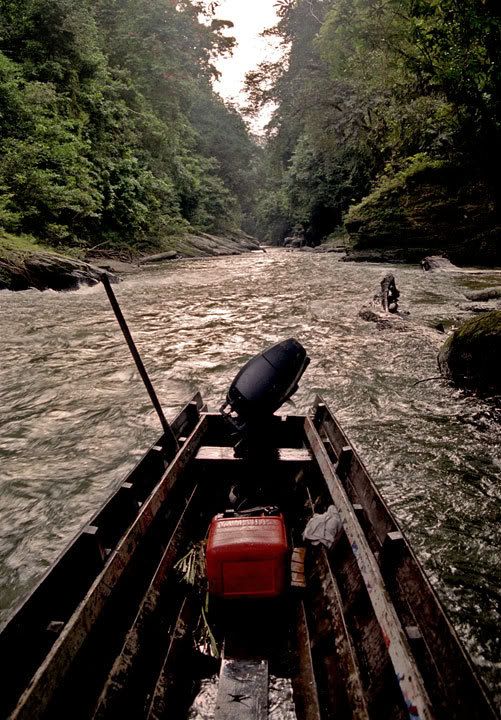
Struggling up the Tekelan river to the Gerugu Naris gorges (far right).
The upper Batang Kanyau became the frontline of border battles fought during the 1963-66 Indonesia-Malaysia Confrontation, followed by counter-insurgency operations against the remnants of the communist PARAKU (Pasukan Rakyat Kalimantan Utara) from 1967 to 1992. Iban support as porters, rowers or guides was crucial to the success of all military operations to both warring sides in the area.
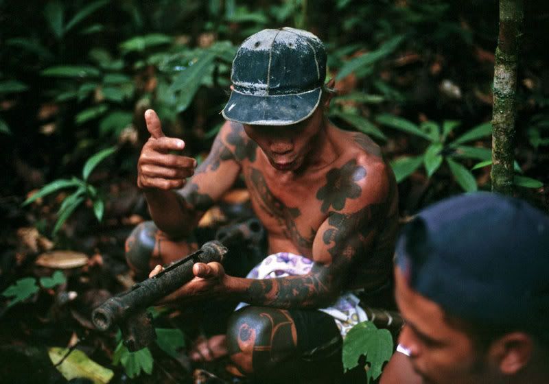
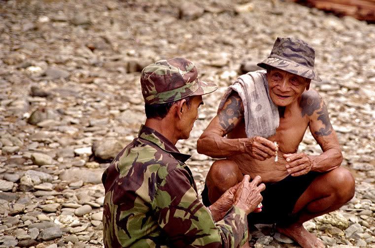
As recently as 2002, weapons and ammunition dumps were still found deep inside the Park. The late Apai Linggong ak. Sandom (1940-2003) shows a recently discovered British-made Stengun (top below), while Panglima Jimbau and Apai Jayang (far below) reminisce about their involvement in the 1967-68 anti-PARAKU operations.
As recently as 2002, weapons and ammunition dumps were still found deep inside the Park. The late Apai Linggong ak. Sandom (1940-2003) shows a recently discovered British-made Stengun (top below), while Panglima Jimbau and Apai Jayang (far below) reminisce about their involvement in the 1967-68 anti-PARAKU operations.
Labels: ethnic groups, Iban, National Parks, West Kalimantan
posted by dlumenta at
10:51 PM
![]()
![]()

0 Comments:
Post a Comment
Subscribe to Post Comments [Atom]
<< Home